![[{[item.product.name]}]]([{[item.product.photo.url]}] 75w)

")
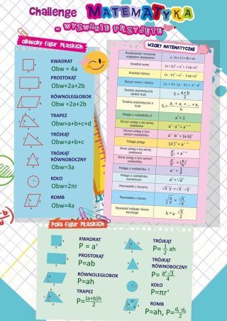
Mapa Polska fizyczna (plakat)
Ogólnogeograficzna mapa Polskiw skali 1 : 1 500 000 szczegółowo pokazuje ukształtowanie powierzchni oraz podaje nazwy krain geograficznych, zarówno tych głównych, np. Pojezierza Wielkopolskiego, jak i pomniejszych, które obejmują, np. Pojezierze Gnieźnieńskie. We wszystkich pasmach górskich oraz innych obszarach o zróżnicowanej rzeźbie terenu podano nazwy i wysokości głwónych wzniesień, przełęczy oraz obniżeń. Treść mapy uzupełniają: szczegółowe sieci hydrograficzna i osadnicza oraz aktualna sieć drogowa. Wersja konturowa (kolorowa) z tyłu służy do własnych ćwiczeń z użyciem suchościeralnego pisaka.
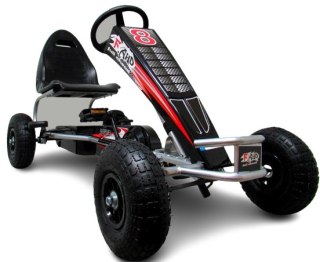
Safety Information
For use under direct adult supervision, Need to use protective measures. Do not use in traffic, Not suitable for children under the specified age. For use under adult supervision, This toy does not offer protection, Includes a toy. Adult supervision recommended
It has the CE mark confirming compliance with the requirements of the European Union directive for this type of device.
CE Declaration of Conformity | Complies with EN-71 - Safety of toys
For children over 3 years of age
It has the CE mark confirming compliance with the requirements of the European Union directive - Compliant with the EN-71 standard - Safety of toys