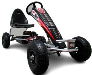
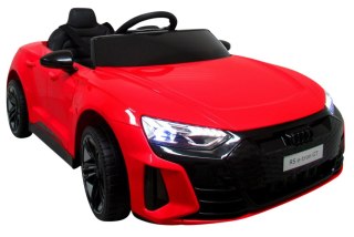
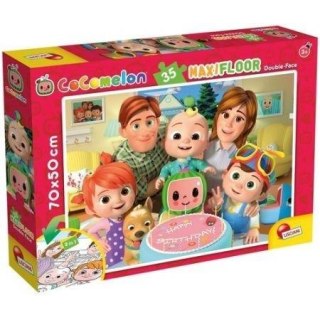
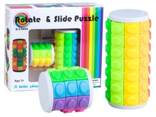
![[{[item.product.name]}]]([{[item.product.photo.url]}] 75w)


Puzzle - Państwa Europy
Europa podział polityczny to mapa, wykonana w skali 1 : 15 000 000.
Nadaje się do nauki nazw państw i ich stolic oraz pomaga w zapamiętaniu przestrzennego rozmieszczenia poszczególnych krajów na kontynencie europejskim.
W dyskretny sposób przedstawia również zarysy najważniejszych pasm górskich w Europie poprzez cieniowanie nałożone na kolory przypisane poszczególnym krajom.
Dodatkowo na planszy umieszczono alfabetyczny wykaz wszystkich oficjalnie uznawanych państw i ich flagi.
Safety Information
For use under direct adult supervision, Need to use protective measures. Do not use in traffic, Not suitable for children under the specified age. For use under adult supervision, This toy does not offer protection, Includes a toy. Adult supervision recommended
It has the CE mark confirming compliance with the requirements of the European Union directive for this type of device.
CE Declaration of Conformity | Complies with EN-71 - Safety of toys
For children over 3 years of age
It has the CE mark confirming compliance with the requirements of the European Union directive - Compliant with the EN-71 standard - Safety of toys