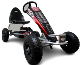
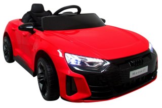
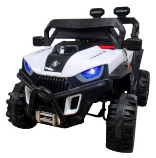
![[{[item.product.name]}]]([{[item.product.photo.url]}] 75w)


Szczegółowa mapa turystyczna z uwzględnieniem atrakcji, zabytków, ciekawych miejsc oraz infrastruktury turystycznej i sportowej. Zawiera aktualny przebieg szlaków pieszych i rowerowych wraz z kilometrażem i orientacyjnymi czasami przejścia. Mapa obejmuje zachodnią część pasma Beskidu Żywieckiego z miejscowościami: Węgierska Górka; Milówka, Korbielów, Rajcza, Zwardoń oraz pograniczem polsko-słowackim. Na mapie zastosowano cieniowanie dla plastycznego ukazania rzeźby terenu.
Informacje dotyczące bezpieczeństwa
Do użytku pod bezpośrednim nadzorem osoby dorosłej, Konieczność stosowania środków ochronnych. Nie używać w ruchu ulicznym, Nie nadaje się dla dzieci poniżej określonego wieku. Do używania pod nadzorem osoby dorosłej, Ta zabawka nie zapewnia ochrony, Zawiera zabawkę. Zalecany nadzór osoby dorosłej
Posiada znak CE potwierdzający spełnienie wymagań dyrektywy Unii Europejskiej dla tego typu urządzeń.
Deklaracja zgodności CE | Zgodne z normą EN-71 - Bezpieczeństwo zabawek
Dla dzieci powyżej 3-go roku życia
Posiada znak CE potwierdzający spełnienie wymagań dyrektywy Unii Europejskiej - Zgodne z normą EN-71 - Bezpieczeństwo zabawek
Dane producenta
ATENEUM M KOGUT
ul. Półłanki 12C
30-740 Kraków
Poland
730260740
[email protected]
Osoba odpowiedzialna
ATENEUM
ul. Półłanki 12C
30-740 Kraków
Poland
730260740
[email protected]